UN
73 Strand Street
£ 325,000
Description
We don't have a Description for this property.
- Bedrooms
- 3
- Bathrooms
- 0

Leaflet © OpenStreetMap contributors
The heatmap indicates the level of crime in the area. The color of the heatmap indicates the crime severity and recency.
Metrics Year-on-Year
- Average area value
- 642,571.00 £Decreased by 5.01 %
- Average area rental value
- 1,045.00 £/moDecreased by 18.93 %
- Est rental Yield
- 1.95 %Decreased by 14.85 %
- Crime Rate
- 14.00 %Unchanged by 0.00 %
from 676,466.00 £
from 1,289.00 £/mo
from 2.29 %
from 14.00 %
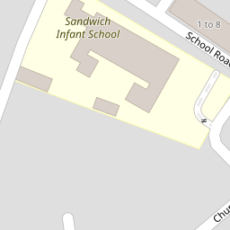
Nearby Schools
| Name | Type | Ofsted | Distance |
|---|---|---|---|
| Sandwich Infant School | Academy Converter | 0.17 KM | |
| Sir Roger Manwood'S School | Academy Converter | Outstanding | 1.04 KM |
| Sandwich Junior School | Community School | Outstanding | 1.06 KM |
| Sandwich Technology School | Academy Converter | Good | 1.44 KM |
| Worth Primary School | Academy Converter | 2.61 KM |
Images
Nearby Streets
| Name | Average Price | Average Sqft | Distance |
|---|---|---|---|
| Church Street St. Marys | £ 0 | 0 | 0.00 KM |
| The Butts | £ 465,000 | 0 | 0.00 KM |
| Ramsgate Road | £ 200,000 | 0 | 0.00 KM |
| Church Street St. Clements | £ 495,000 | 0 | 0.00 KM |
| Alliss Gardens | £ 458,750 | 0 | 0.00 KM |
Nearby Transport
| Name | NLC | TLC | Distance |
|---|---|---|---|
| Sandwich | 5026 | SDW | 1.01 KM |
| Minster | 5019 | MSR | 6.17 KM |
| Deal | 5011 | DEA | 9.07 KM |
| Walmer | 5041 | WAM | 9.65 KM |
Nearby Listings
| Address | Price | Type | Score | Distance |
|---|---|---|---|---|
| Sandwich | £ 312,500 | BUY | 7 / 10 | 0.13 KM |
| Vicarage Lane, Sandwich | £ 360,000 | BUY | 6 / 10 | 0.14 KM |
| Vicarage Lane, Sandwich | £ 350,000 | BUY | Unknown | 0.15 KM |
| Strand Street, Sandwich, Kent, CT13 | £ 305,000 | BUY | Unknown | 0.15 KM |
| School Road, Sandwich, Kent, CT13 | £ 320,000 | BUY | 7 / 10 | 0.16 KM |
Nearby Properties
| Address | Price | Distance |
|---|---|---|
| 67 Strand Street | £ 333,000 | 0.00 KM |
| 73 Strand Street | £ 325,000 | 0.00 KM |
| 81 Strand Street | £ 146,000 | 0.10 KM |
| 85 Strand Street | £ 158,000 | 0.10 KM |
| 62 Strand Street | £ 490,000 | 0.10 KM |